
Exploring Old North + Bloody Knees
Sometime in the next couple weeks I have been planning to bag Bountiful Peak (before snow hits). The best trail options are the Farmington Spine or the Parrish switchbacks. I have long wanted to go straight up Davis Creek though to the. I have heard that the trail fades – just like the Bountiful Peak trail and the Centennial Trail (up from Flag Rock). However, after doing a little research, it looked like Old North might be a good option. It is a large ridge the pops up in the middle of Davis Creek Canyon. The trail up to the first ridge is apparently pretty good and from there the ridgelines look fairly clear – not heavy bushwhacks.
Before doing a full ascent, I decided to do some recon.
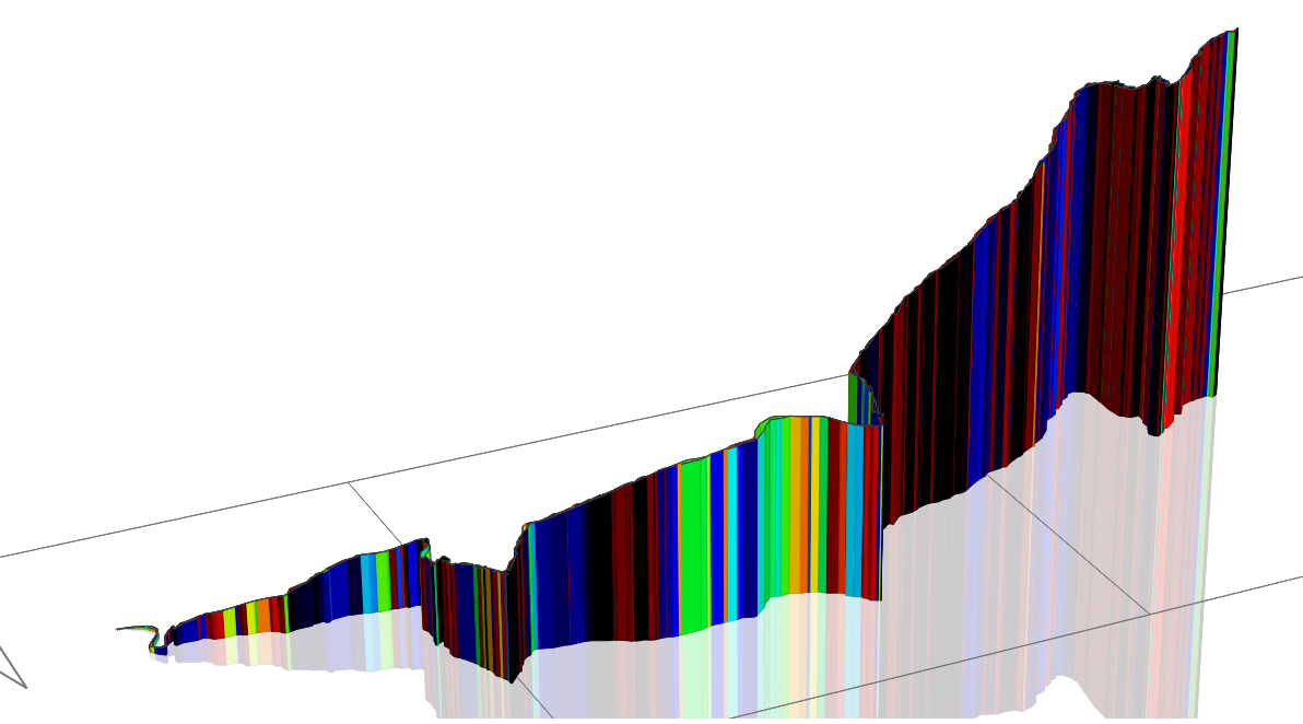
4.1 miles in 1:15:38 @ 18:24 min/mile and with 2,350 ft. elevation gain (in the first 2 miles)

Up the Davis Creek Trail I flew. I decided to push hard and see if I could reclaim some of the course records on the Strava segments going up from the trail head to the Hell Hole / Pretty Valley split. I did get some PRs, but no CRs. I really pushed hard – but lets face it, I’m just not that fast.

I took the left split to Hell Hole.
After the brutal climb, the trail levels out for the last 1/4 mile to Hell Hole and even goes down a bit. I was so excited to be able to actually get a full stride in that I started to run…and immediately tripped and full-out face-planted on the trail. It happened so fast, I didn’t have time to even try to catch myself. Scraped arms, nose, and knee. Ouch.


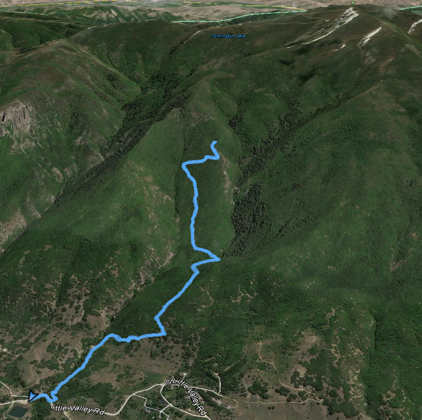
The Old North Trail starts after crossing Davis Creek at Hell Hole. I followed it about 3/4 mile up to the top of the first big ridge clearing. Some nice rocks. Inexplicably, a broad and ZERO bushwhack trail appears at the top of the ridge. It must be remnants of an old mining road or something.

In any case, the ridge goes northeast and then climbs to intersect a higher ridge at Midway Peak. That ridge then goes southeast to Bountiful Peak. I was hoping to make it to Midway Peak but right as I got up on the open ridge – thunder and lightning.

I made a quick retreat back down the 2 miles to my car.
It was a successful recon though – I will definitely go back up it to Bountiful Peak, probably in a couple Saturdays
.I’ll be sore though. It was 2,350 ft. in elevation gain over 2 miles of trail. Wow!
